Trung tâm phòng tránh và giảm nhẹ thiên tai

Disaster Management Policyand Technology Center

Giao diện dễ tiếp cận vietnam english
Log in

Management - Cooperation - Work together

  • Homepage
  • About
    • About DMC
    • Organization Structure
    • Function & Tasks
    • Development stratery
  • News
    • National and International News
    • DMPTC News
  • Information Center
    • Disaster infomation
    • Basic knowledge
    • Library
      • Legal documents
      • Reference documents
      • IEC documents
      • CBDRM documents
        • Legal documents
        • Reference documents
        • IEC documents
    • CBDRM (Program 1002)
      • Project Matrix
      • Technical Assistance Network
      • CBDRM documents
        • Legal documents
        • Reference documents
        • IEC documents
      • Monitoring and Evaluation (M&E)
      • CBDRA
        • Disaster risks maps
        • CBDRA Reports
        • Other maps
      • Disaster prevention plans
    • Disaster risk maps
    • Irrigation systems
    • Trainings and Workshops
    • Gallery
  • Partners
  • Projects
  • DMC-Mail
  1. News
  2. Details
  • Share this on Facebook
  • Share this on Twitter
  • Share this on GooglePlus

Tourists sit on boats and cyclos to visit Hoi An on the day the Hoai River rises

10:39:48, 15/11/2022 During the day when the water of Hoai River rose, causing local flooding of some roads, tourists enjoyed riding boats and cyclos to visit the old town.


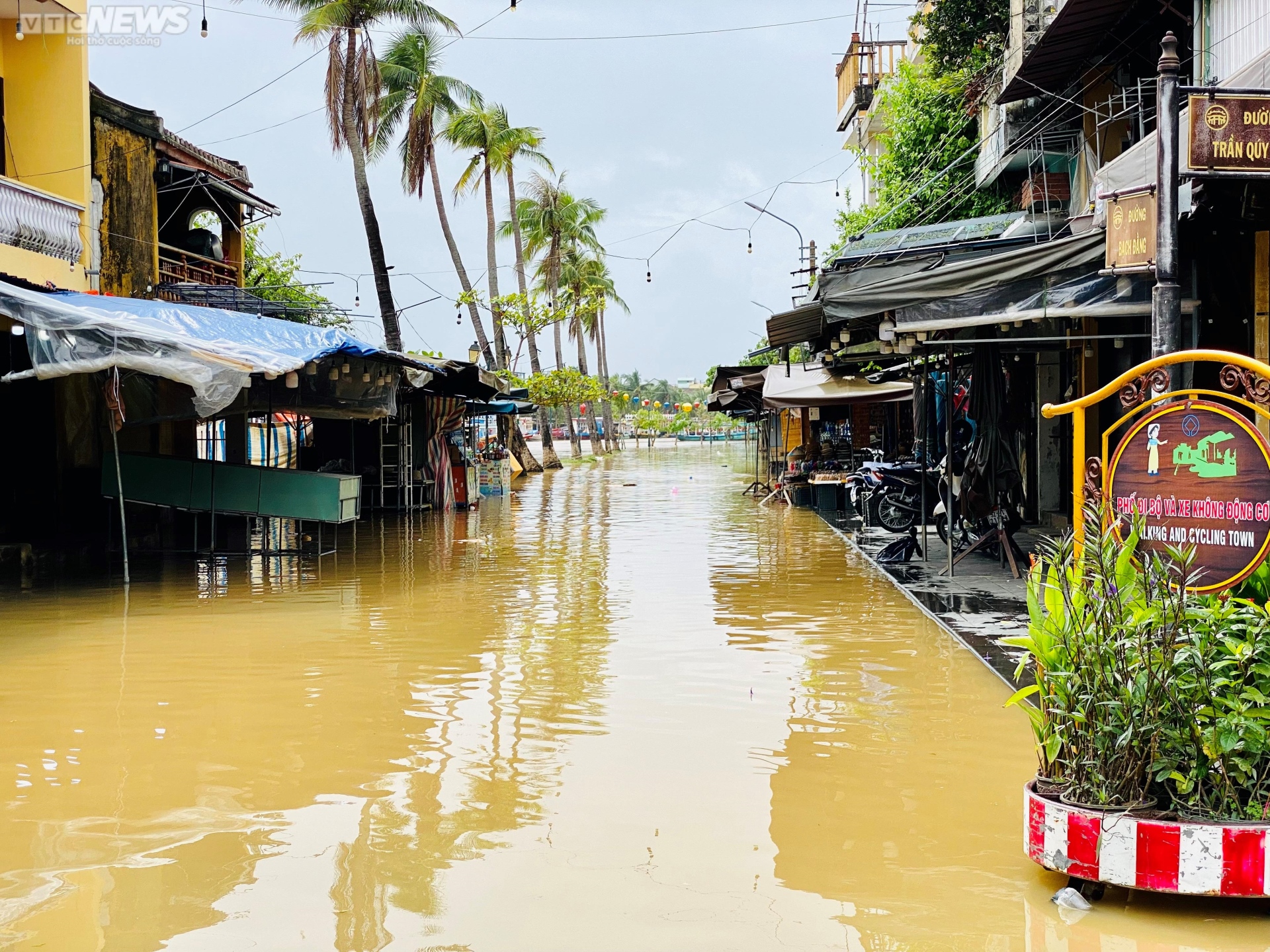
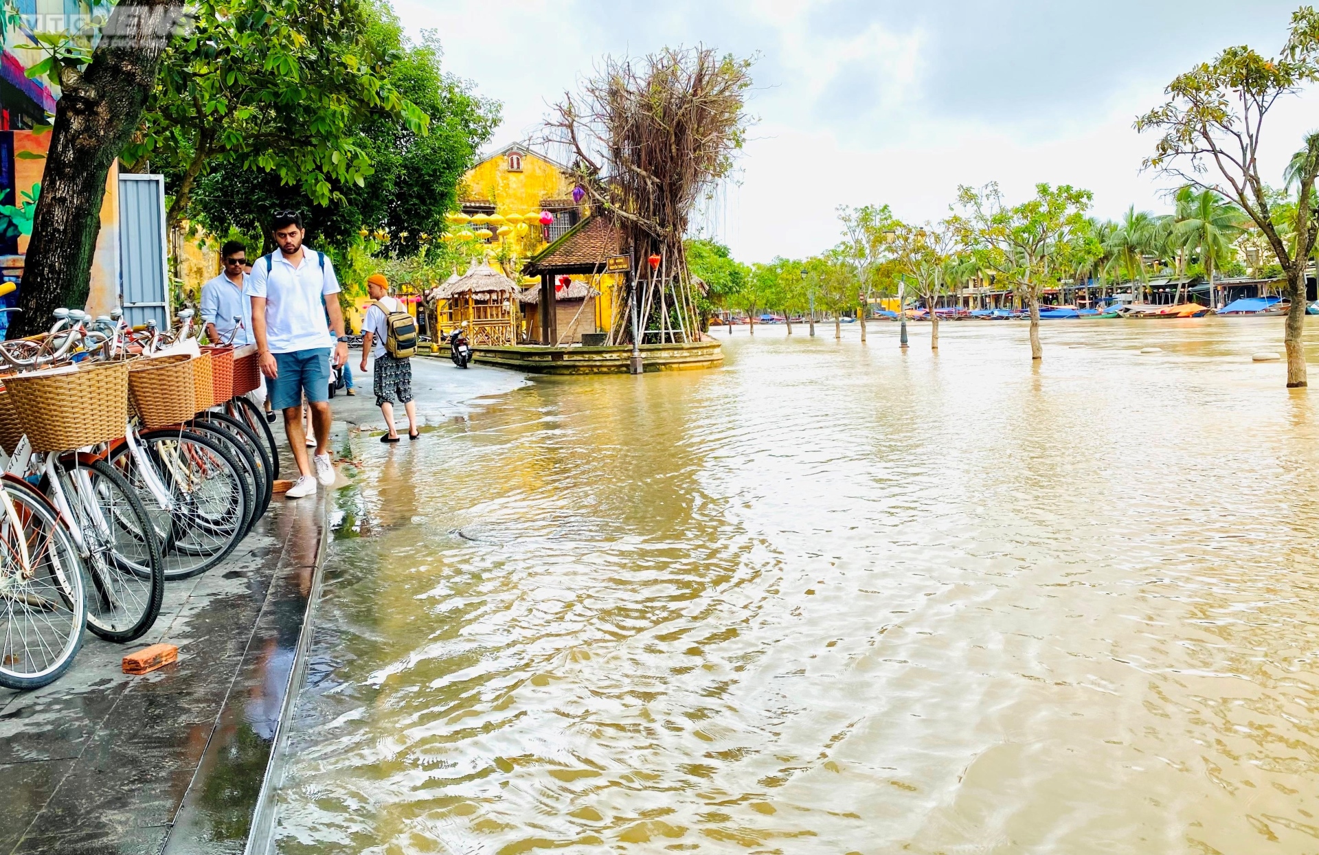
In the early afternoon of October 26, water from under the Hoai River (a tributary of the Thu Bon River flowing through Hoi An Ancient Town, Quang Nam Province) - was still showing signs of rising, causing local flooding in some areas in the neighborhood. neck.


Mr. Nguyen The Hung - Vice Chairman of Hoi An City People's Committee said that heavy rain yesterday (October 25), combined with water from upstream, caused the water level of Hoai River to rise. The water level in Hoi An at 12 o'clock on October 26 is 1.19m.


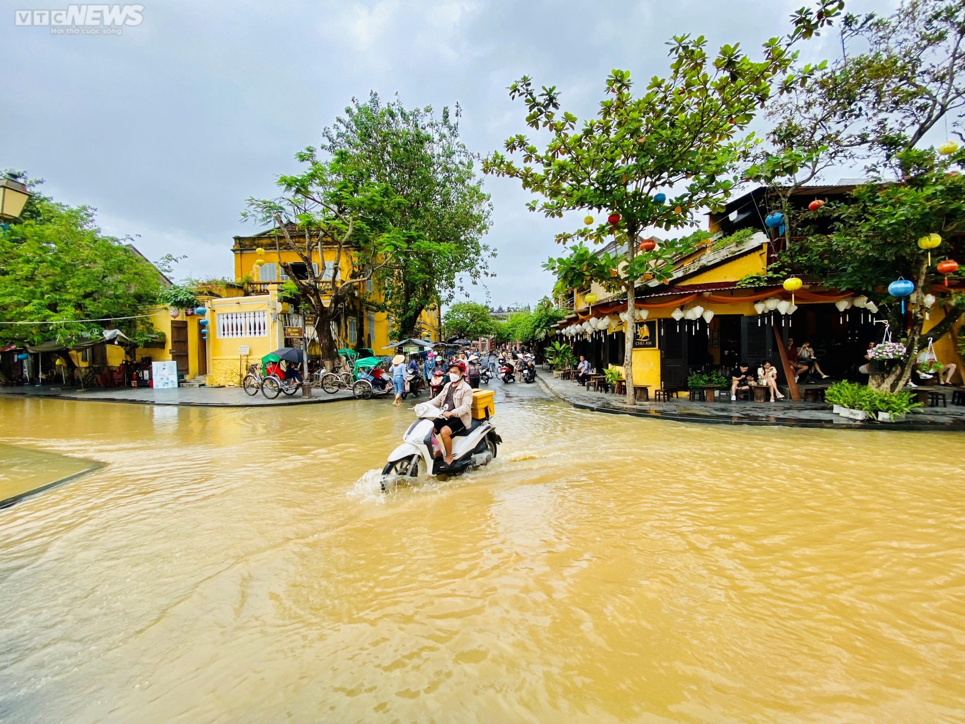
As noted, in streets like Bach Dang, Le Loi, Hoang Van Thu, water is flooding. In particular, on Bach Dang road running along the river, some sections flooded more than 30cm, making it difficult for vehicles to move through.


People riding motorbikes and tourists walking from An Hoi side to the intersection between Bach Dang and Nguyen Thai Hoc streets have to cross the water.


Afraid to wade in the water, many tourists when going through the above intersection have to move to the sidewalk.


(Source: vtc.vn)

Read more

  • Spreading Humanitarian Spirit: Giving Hope to People in Flood-Affected Areas
  • Dong Thap Takes Early Action to Cope with Drought and Saltwater Intrusion
  • Brazil: 55 people killed by floods.
  • Community-Based Disaster Risk Management
  • A Peaceful Tet for Disaster-Affected Communities
  • Many European residents are affected by natural disasters.
  • WMO Calls for Strengthened Early Warning Systems Amid Extreme Weather
  • Record Snowfall in Japan Paralyzes Transport, At Least Four Dead
  • Indonesia Steps Up Search and Rescue Efforts
  • Saltwater Intrusion Intensifies Along Vam Co River, Residents Urged to Store Fresh Water


  • Vietnam Natural Disaster Monitoring System (VNDMS)

  • Community-Based Disaster Risk Management Database (Project 553)

  • Socio-economic database

  • Riverbank landslides, coastal erosion database

  • Spatial for disaster management database

  • Library Disaster Management Policy and and Technology Center

  • Damage database

  • Satellite database

  • Science and Technology Database

  • Online Knowledge Dissemination Software for Disaster Prevention

  • Digital transformation portal in disaster management

  • Camera Management and Monitoring Software

Weather forecast

Copyright © 2015 - Disaster Management Policy and Technology Center

Address: No.54 - 102 Truong Chinh street, Dong Da, Ha Noi

Phone: +84-436291511 - Fax: +84-437336647

Email: trungtamcsktpctt@gmail.com - Website: www.dmptc.gov.vn

Online users: 1210

Visistors: 78211